By Zade Viggers, 10 May 2025
Hazel and Fliss organised a little trip into the Ōrongorongo valley for their 20th birthdays. Somehow, Sean, Fliss, and I ended up at 700m hanging from a crumbly rock by our fingertips, staring into Death's sweet black eyes.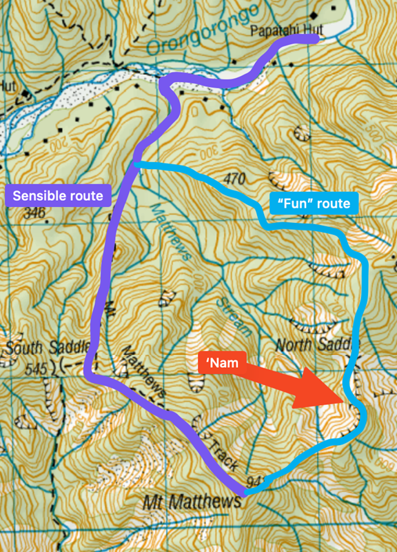
Ten of us had walked into Papatahi hut that morning. Having lightened our packs, we all set off down the braided river towards Mount Matthews.
The sensible folk all walked up the marked DOC route. Our little triad of intrepid adventurers instead took a left into dense bush just before the marked trail heads uphill.
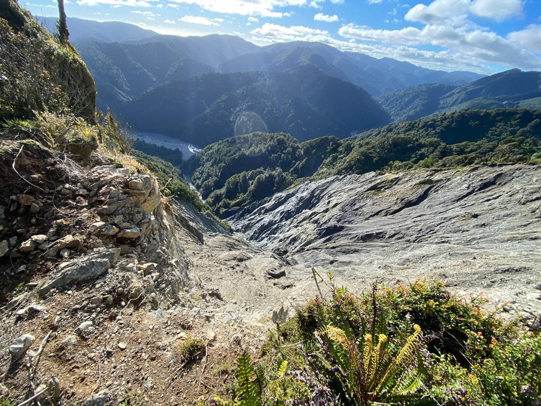
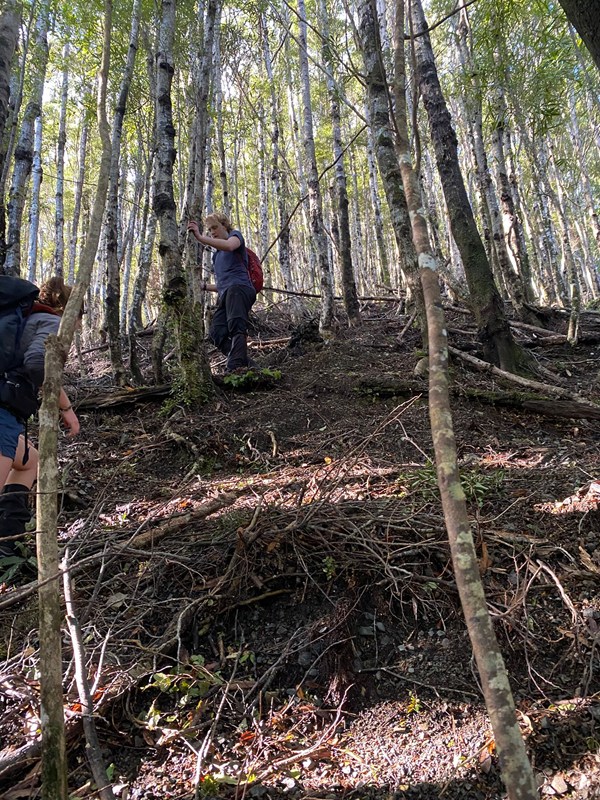 After battling through some pretty intense vines, we broke into some steep but sparse beech forest. It was a pretty enjoyable climb up the hill - we eventually found a trapping trail which made it much easier going. We got some cool views, especially when we got to the large slip on our left, which was a sight to behold.
As we traversed around, we got occasional views of the knife edge to come - it looked sketchy, but we had read trip reports that promised a bypass track, so we knew we'd be fine.
Making our way along the North Saddle was rough but doable, with exposed, dense shrub-bashing in strong winds. When we stopped for lunch, lying under a bush, we played a game of where's Waldo with Finlay across on the main ridge - he eventually managed to spot my bright orange jacket.
After lunch, we had a minor incident involving losing the track, wandering off the edge of the ridge, and climbing up through near-vertical shrub to get back. Here we also encountered large quantities of an evil blight known only as speargrass. It blends in with the shrubbery, grows just where you're most likely to place your hand for a good hold, and pierces straight to the bone. It grows just sparsely enough that you eventually drop your guard looking out for it, only to be once again greeted with a terrible shooting pain in your palm.
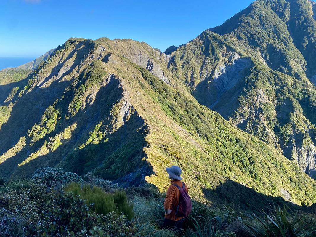
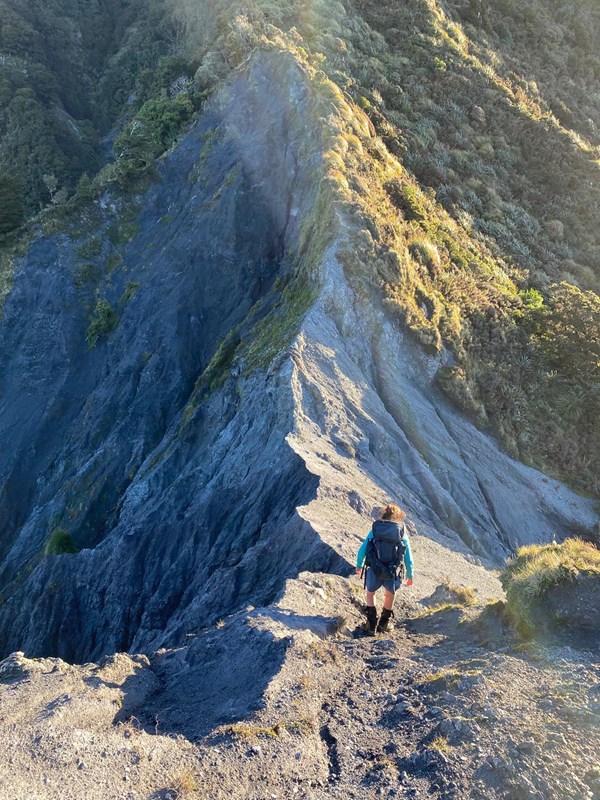 Eventually, we made it to the infamous knife edge. And what an apt name. Photos do not capture just how horrible this little terrain feature is. On your left (east), you have a ~20m sheer drop onto hard rocks, the "no-fall zone". On your right (west) is a ~3m 45 degree stone and gravel slope, before it also falls off a cliff, this time into a more forested area.
That bypass track we read about? Pretty sure it's gone. We certainly couldn't find it, and saw a big slip where reports indicated it was. So our options were to traverse this knife edge, or go the long way back.
The knife edge can be thought of as three parts. We came from the north, and so had something of a warm up in section 1, a slightly sketchy, but on the whole not horrific exposed section of rock (especially compared to later). This is a warm up for your nerves, since they sure as hell will need it. Section 2 is the knife edge itself, a tiny sharp. ridgeline of crumbly rock. There are two strategies that can be employed here: the straddle and the deadhang. Straddling the edge feels more stable, but the topography of the area funnels wind into you from the west, threatening to push you off the big ol' cliff to your left. The deadhang strategy involves gripping the crumbly edge with your hands, leaving your feet dangling/scarping at more crumbly rock that provides little to no support.

Employing either strategy, you slowly edge forward (south) along the ridge until you reach the final crux (section 3). This is the worst section of all. You are faced with a wall of rock, with a slope on its western side. The obvious way is an easy-looking boulder problem straight up it, with the slight complications that if you fall, you go off a cliff and die, and the rock that should be supporting you crumbles when looked at funny. Fliss and Sean instead opted to do a traverse along the western rocky slope, using some slight lumps in the surface as holds to quickly scamper around to the much more solid shurbs.
I was left in a predicament, as the holds the other two used turned out to be single-use, crumbling away down the slope. After sitting there straddling the knife edge for a few minutes, all too aware of the wind that so deperatley wanted my to tilt just a few extra degrees to 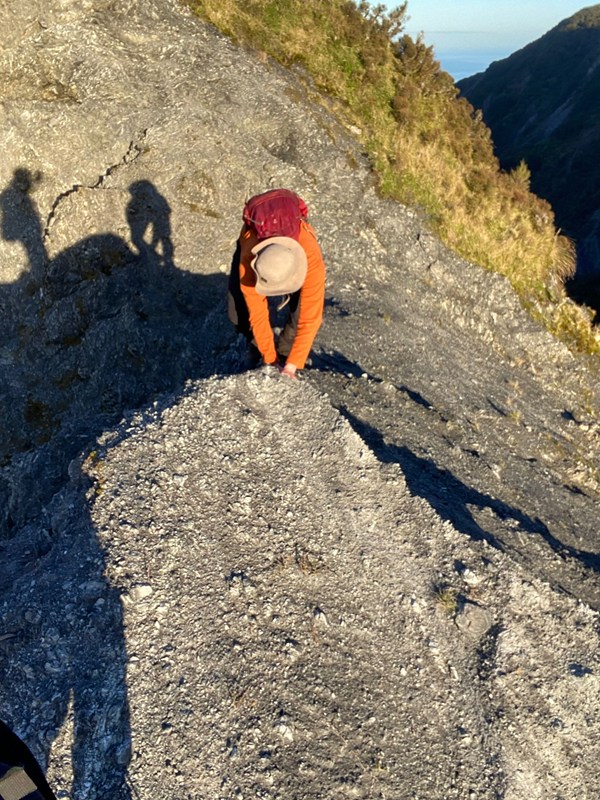 my left, and reconsidering my choices that led to this moment, I opted to slide partway down the western slope, before quickly traversing a small (and also unstable) gravel patch just above the western cliff. Those sharp, stiff, prickly shrubs were the most wonderful thing I had ever felt in that moment as I made it to relative safety.
All having survived the worst, we slogged on up the western ridge of Mt Matthews as darkness descended. We made it to the top, and cracked a beer (yes I was carrying three cans of beer this whole time.) Everyone else had long made it to the top and back down. We took the marked route down. Fliss' knee was not doing great by this point, and it took us a while to reach Papatahi hut (luckily, there were many more beers waiting there.)
Happy birthday, Fliss and Hazel!!